Skip to content

TaiwanAirBlog

since 2006

Menu
  • About
Menu

後龍飛行場平面圖 (Koryu Airdrome on Google Earth & Maps)

Posted on May 7, 2011

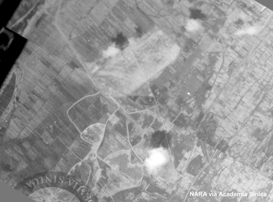
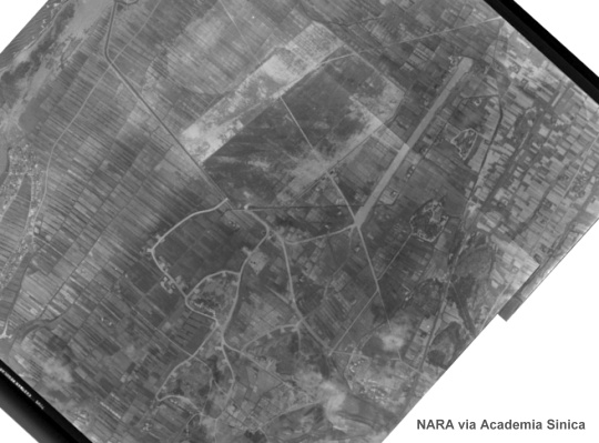
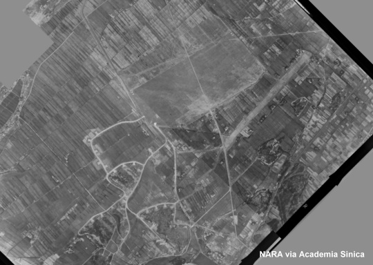
上面這張1944年空照圖中的後龍飛行場仍未完成,如果跟以下兩張1945年的照片比較,可以發現有些飛機掩體還沒有建好,也少了那一條看起來很像跑道的主滑行道,著陸區的面積也比較小。
The 1944 reconnaissance photo reveals the then unfinished Koryu Airdrome (currently Houlong in Miaoli County). By the time when the next two photos were taken in 1945, all the revetments had been completed, the main taxiway, as long and wide as a runway, had taken shape, and the landing area had been expanded.

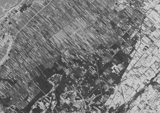
1945年的「台灣區各機場要圖」對這座已經從日軍移交給國軍的機場的描述是「場內雜草密生,使用不能」,相信它很快就被移作原來的用途–農地,所以下面這張1966年的CORONA衛星照片上完全看不出這片土地上曾經有一座大型飛行場的存在。
Soon after WWII, this large military installation was returned to agriculture. In the following 1966 CORONA satellite image, there is virtually nothing indicative of an airfield.

聽說仁德醫護管理專科學校附近還可以看到日軍遺留下來的建物,而後龍飛行場的遺址從後龍火車站步行可及,所以也許哪天我會去看看。

  • Download the kmz file of the airdrome plan for Google Earth.
  • View the airdrome plan on Google Maps.
Share on Social Media
x facebook tumblr reddit
Post Views: 203

1 thought on “後龍飛行場平面圖 (Koryu Airdrome on Google Earth & Maps)”

  1. Gene says:
    May 8, 2011 at 7:35 am

    Thanks again.
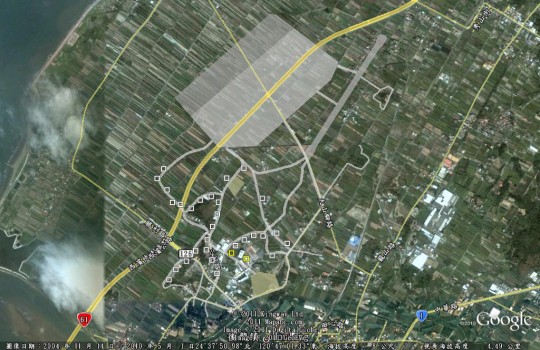
    Notice that almost in the middle of the airfield is the present day location of
    the VOR HLG

Comments are closed.

Recent Posts

  • 孤證不立
  • 相關性不等於因果關係
  • 免於戰犯審判的分所長
  • 人非聖賢
  • 一次無功而返的任務

Recent Comments

  1. Administrator on 大膽假設,小心求證
  2. ZY on 大膽假設,小心求證
  3. Kenneth R Becht on Shu Lin Kou Air Station (Updated)
  4. Administrator on 中情局對黑貓中隊飛行員的死亡撫卹金
  5. Brian on 中情局對黑貓中隊飛行員的死亡撫卹金

Archives

35th Sq. B-24 B-25 B-29 Bombing Formosa CIA CORONA Google Hsichun Mike Hua KH-4A KH-4B POW TACKLE Takao Task Force 38 TBM Tom Wang U-2 中央情報局 中情局 卓蘭 嘉義 屏東 張立義 快刀計畫 戰俘 戰俘營 新竹 日月潭 日治時期機場 李南屏 楊世駒 王濤 空襲台灣 第22轟炸大隊 第38特遣艦隊 第38轟炸大隊 第43轟炸大隊 臺灣俘虜收容所 華錫鈞 陳懷 飛行場 高雄 黃七賢 黑貓中隊

©2025 TaiwanAirBlog | Design: Newspaperly WordPress Theme