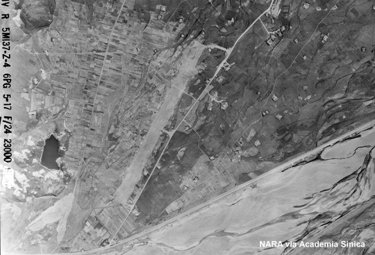
看到標題時,您可能會認為「西」的英文縮寫不是W嗎,怎麼會寫成S呢?一般所稱的宜蘭南機場,位於宜蘭運動公園和縣政中心之間。但是上圖這座被美軍稱為Giran S. Airdrome的飛行場則座落於現今的員山鄉境內,劉鳳翰的「日軍在台灣」稱之為宜蘭(西)飛行場。為了方便日後用不同的語言檢索,所以我故意採用了不一致的名稱,請各位見諒。
The airfield in the above photo, located in Yuanshan Township of Yilan County, was referred to as Giran S. by the American military during WWII. But it is different from the Giran S. Airdrome known to most people nowadays, which is located between Yilan Sports Park and Yilan County Administrative Center in Yilan City.
基本上這座飛行場只是一條跑道而已,透過三條滑行道與現在的員山路連接。仔細看的話,可以發現東北端滑行道所連接的員山路有一段被特意拓寬,應該是用來停放飛機的:
This airfield consisted of a single runway and three taxiways connecting to the current Yuanshan Road. A section of Yuanshan Road near the northeastern end of the ruwnay had been widened, mostly likely serving as an apron for the aircraft:
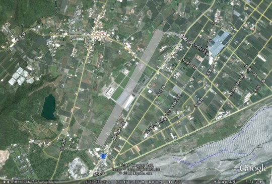
下圖是根據1945年空照圖繪製的宜蘭(西)飛行場平面圖,您也可以利用以下兩個連結在Google Earth或Google Maps上探索:
I had looked for this airfield a few years ago. Although I searched the surrounding area I could never find anything that resembled an airfield or any thing associated with an airfield in that area. I figured it was somewhere around the Army Military installation to the North West of the present location that you located. Thanks for your research. In the book there was an airfield located at the site of the 923 earthquake southwest of Puli. 23 58, 120 50. Now I heard it was along the river just south of Wufong to the East. Not sure if it was on the North or South side. Keep up the excellent work.
Gene: I haven’t been able to locate the Puli airfield because I don’t have recon photos of that area. Do you know there used to an airfield in Caotun (23 58, 120 40)?
謝謝分享
這個飛行場,應該算是在台灣消失的機場裡面,算是比較有名的。
也是神風隊的基地
nn: 這座位在員山鄉的飛行場只有簡單的構造,看來比較像備用的機場。我在網路上看到的,多半是說位於宜蘭市區的宜蘭南機場是過去神風特攻隊的基地。我在標題所用的Giran S.名稱是配合美軍在照片上所做的註記。這其中可能有誤解?
http://pylin.kaishao.idv.tw/?p=56
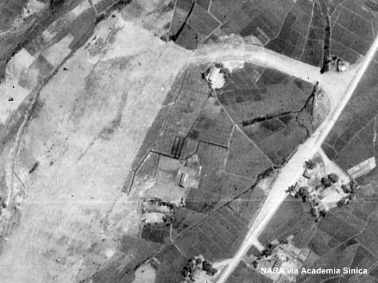
草屯機場
在美軍1951偵照,罐號f12396底片內,第54張就是草屯機場.
WENWANG: 我已經在作草屯機場的照片比對,不過地貌改變甚大,Google Earth也尚未提供高解析度衛星照片,所以平面圖會遲一些提供。
那肯定是我搞錯飛行場了
我應該說的是宜蘭市區那座飛行場
現在變成運動公園的那座