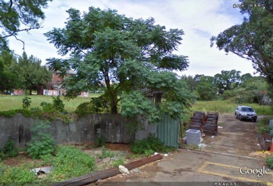
This Google Street View photo was taken at the gate of now abandoned Lungkang (龍岡) Army Airfield. The brick building behind the trees on the left used to be a hangar when base was active.
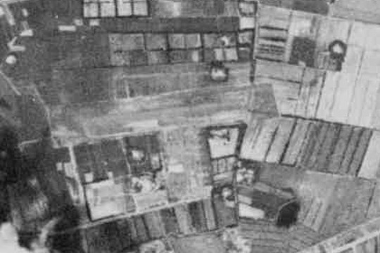
Lungkang was inaugurated on May 22, 1959 and served as the base for ROC Army’s L-19 light observation aircraft. The following image was taken by a CORONA satellite in 1966:
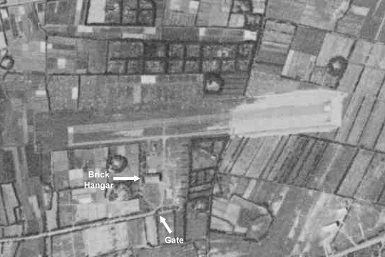
By 1969, the runway had been extended toward the east. The extension is clearly visible in the 1969 CORONA image:
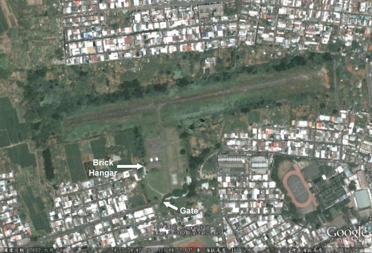
It is said that the deactivation of Lungkang was related to the defection of an ROC Army U-6A to China in 1983. Its close proximity to Chungli (中壢) probably also played a role. Anyway, this is what it looked like in 2002:
Related links:
- This blog has several photos taken at Lungkang’s inauguration in 1959.
- This blogger ventured into the abandoned airfield in 2009 and took these photos.
在影片撥放第3分鐘開始就會有當時龍岡機場使用情形
http://catalog.digitalarchives.tw/dacs5/System/Exhibition/Detail.jsp?OID=3807317
請問:
我可以使用您的照片來做龍岡演進的介紹嗎?
謝謝
AONEONE: 那兩張黑白照片拿去用沒問題,其它的我就不便說什麼了。