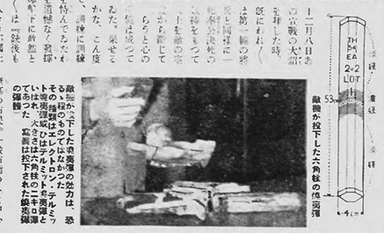
In Japan, the Photographic Weekly (写真週報) No. 218 published an article on Doolittle’s raid on April 29, claiming “the enemy’s air raid attempt was a total failure.” The article included a photo of an unexploded incendiary bomb founded after the raid:
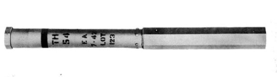
The drawing appears to be that of the AN-M54 4-lb incendiary bomb:
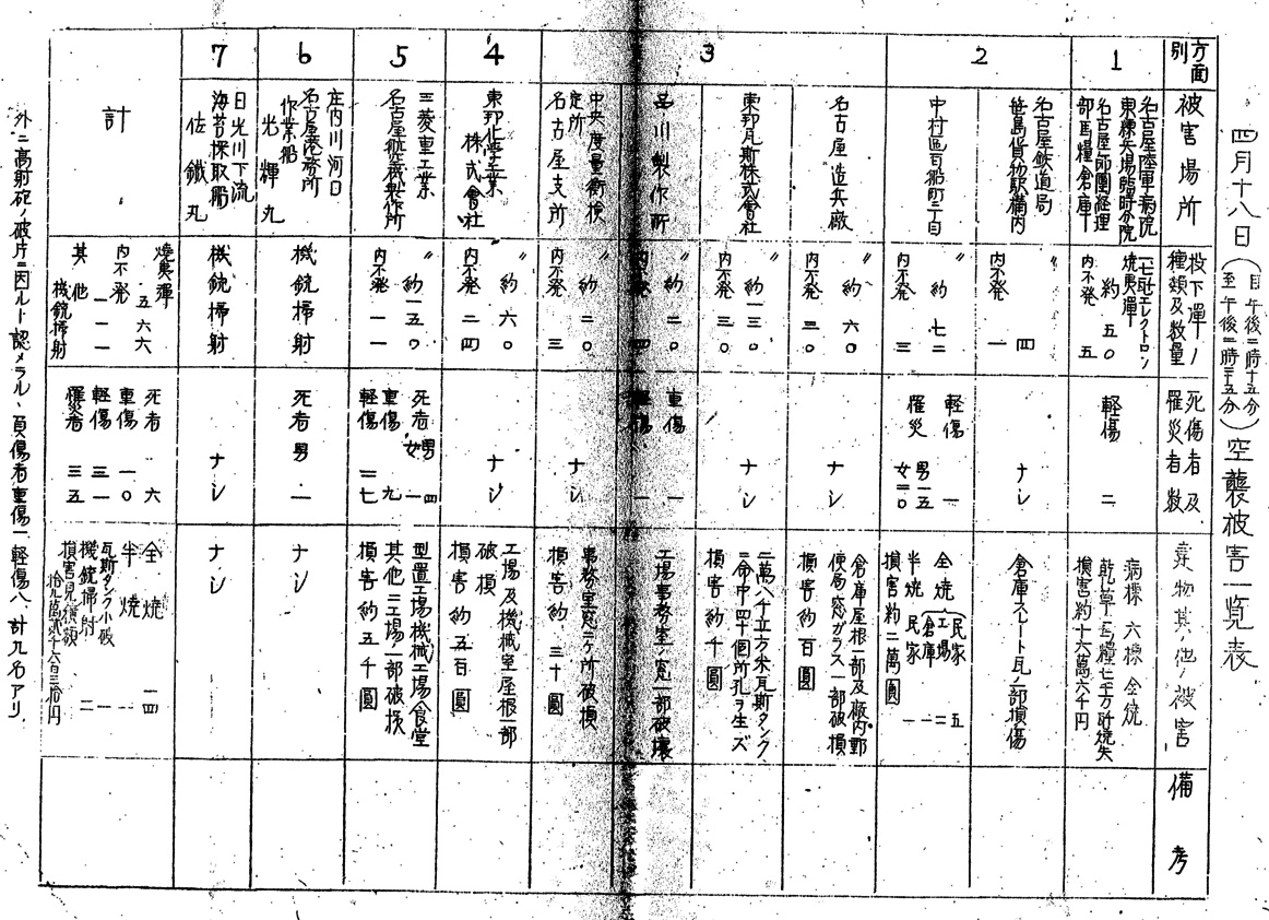
There is also a document detailing the damages done to Nagoya (名古屋), which includes the following summary table. Click on the image to see the full-size version.
The same document contains several drawings showing the locations where the bombs fell. The first one covers a residential area, with the arrow indicating the direction of the bombing run.
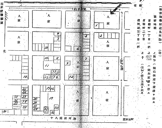
The following Google Maps view shows the approximate area in the above drawing:
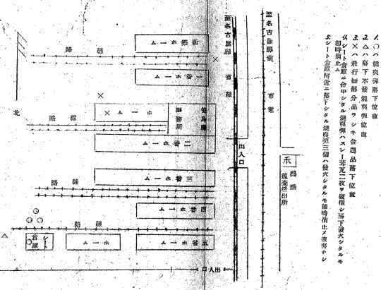
The second drawing is that of Sasashima (笹島) Freight Yard. The circles represent the locations where incendiary bombs fell, the triangles are where unexploded incendiary bombs were found, and the crosses are where metal parts from the bombers were found.
Aerial reconnaissance photo of the freight yard taken by American aircraft (ca. 1944):
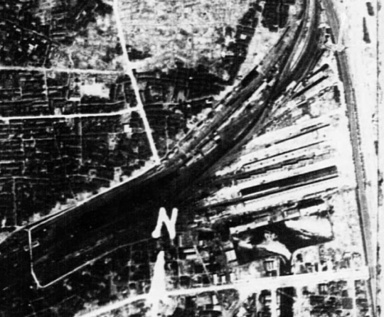
The freight yard was decommissioned in 1986 and subsequently torn down, hence nothing on the Google Maps view:
The third draw depicts the damages to Toho Gas Company (東邦瓦斯株式会社). The crosses mark where the incendiary bombs were dropped.
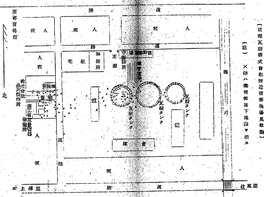
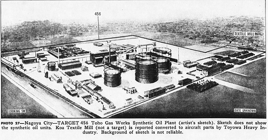
The next image is the sketch of Toho Gas Company found in a US military intelligence analysis report.
Toho Gas Company is still in business at the same location today:
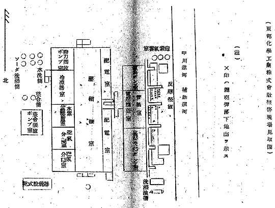
The fourth and last drawing shows Toho Chemical Industry Company (東邦化學工業株式会社). However, I was not able to locate this company on the map of Nagoya.
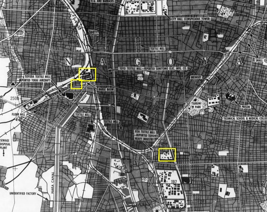
The areas corresponding to the first three drawings are showing in the following map. The smallest rectangle represents the residential area in the first drawing, the one next to it Sasashima Freight Yard, and the one on lower right Toho Gas.
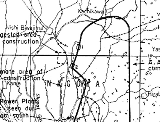
The following map, included in the after-action reports filed after the Doolittle raiders returned to the US, shows the flight path of the B-25 bomber 40-2297 piloted by Major Hilger. We can see that the drawn path is slightly off the actual one by comparing with the previous map.