
Source:NARA via Academia Sinica 中央研究院臺灣文史資源海外徵集與國際合作計畫「美國國家檔案館典藏臺灣舊航空照片」 (G03489)
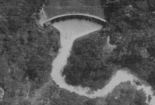
The above photo of Jitsugetsu Power Plant No. 2 (Target 83) was taken on March 23, 1945, by American aircraft only moments before it dropped bombs on this hydro-electric facility. Water source for Power Plant No. 2 actually came from Power Plant No. 1, which was first collected in Chianggwei Dam (literally Gun Cabinet Dam) in the photo below (taken on the same day) and then sent to Power Plant No. 2 by penstocks. The switchgear can be seen on the left-hand side of the powerhouse in the above photo.
上面這張日月潭第二發電所的照片是由1945年3月23日轟炸日月潭的美國飛機在對它投下炸彈前所攝。第二發電所利用第一發電所發電後的尾水,先由銃櫃壩(如下圖,照片攝於同一天)攔截後,再由壓力鋼管送到第二發電所的發電機。上圖可見其變電設施就位於發電所的左側(實際地理位置是北側)。
Source:NARA via Academia Sinica 中央研究院臺灣文史資源海外徵集與國際合作計畫「美國國家檔案館典藏臺灣舊航空照片」 (G03489)
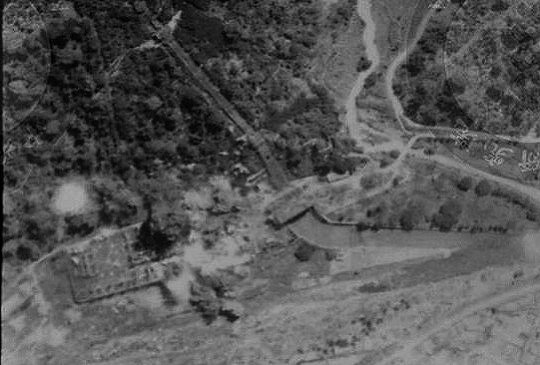
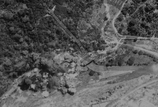
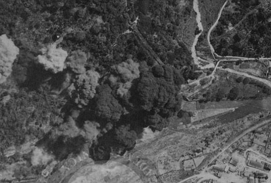
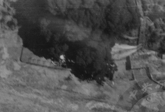
In the series of photos below, it can be seen that the switchgear was struck by bombs and burned. Black smoke eventually shrouded the facility.
在以下的連續照片裡,第二發電所的變電設施被炸中,冒出濃濃黑煙,最後籠罩了整座發電所。
Source:NARA via Academia Sinica 中央研究院臺灣文史資源海外徵集與國際合作計畫「美國國家檔案館典藏臺灣舊航空照片」 (G03489)
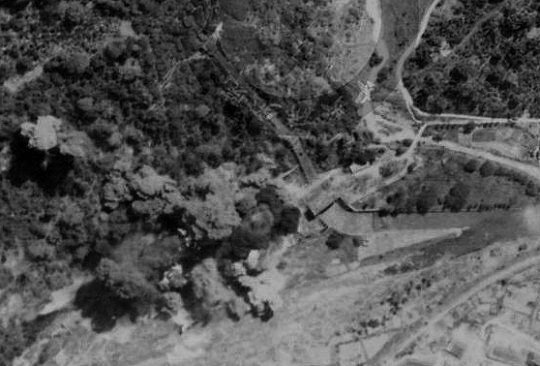
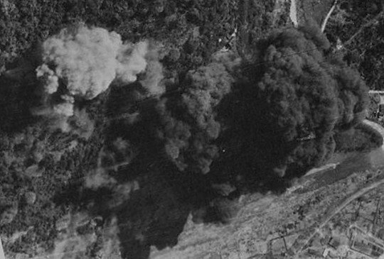
In the first photo below, black smoke continued to billow from the burning switchgear and a penstock was punctured. In the second photo, more water spilled from the ruptured penstocks.
以下第一張照片可見一根壓力水管已經破裂,在第二張照片裡,水管有更多破洞,水柱就從破洞激射而出。

Source:NARA via Academia Sinica 中央研究院臺灣文史資源海外徵集與國際合作計畫「美國國家檔案館典藏臺灣舊航空照片」 (G03489)
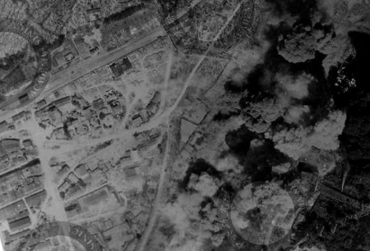
Suiri village (currently Shueili Township) lied on the opposite side of Suiri River from Power Plant No. 2. The next photo shows that the village was near missed. I am not sure if any bomb fell in the village on that day.
水里市街就隔著水里溪與第二發電所對望,下面這張照片可見轟炸現場之近,但我不確定當天水里是否曾被炸中。
Source:NARA via Academia Sinica 中央研究院臺灣文史資源海外徵集與國際合作計畫「美國國家檔案館典藏臺灣舊航空照片」 (G03489)
You may want to compare the current satellite image of Suiri with the above photo:
下面Google Maps的圖對應了上圖裡的區域:
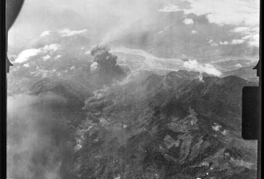
Smoke could be seen miles away:
數里外仍可見爆炸的黑煙:
Source:NARA via Academia Sinica 中央研究院臺灣文史資源海
外徵集與國際合作計畫「美國國家檔案館典藏臺灣舊航空照片」 (G03489)
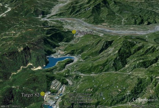
Google Earth view of the same area as in the above photo:
用Google Earth以相同的角度看上圖中的區域:
Source:Google Earth
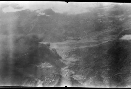
Another aerial view:
另一張遠望的空拍照片:
Source:NARA via Academia Sinica 中央研究院臺灣文史資源海
外徵集與國際合作計畫「美國國家檔案館典藏臺灣舊航空照片」 (G03489)
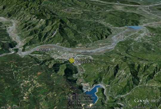
Google Earth view of the same area as in the above photo:
用Google Earth以相同的角度看上圖中的區域:
Source:Google Earth
我找時間貼出1945.10
OSS來台所拍寫真
讓我們能透過網路交談
戰後美國國務院展現對台灣濃厚興趣,派情報小組黃鶯Canary在停戰後到台灣調查(1945/9~1946/4),留有Office of Strategic Services Intelligence Dissemination Number A-64132等報告。此小組在台灣採購40多箱的台灣資料送回美國。1945/12/1有10頁「Bomb Damage in Formosa」,電力只8行,其中記錄1945/3/13及23的轟炸才是致命的,日月潭第一5條壓力鋼管中有2條受損,變壓器燒毀;日月潭第二變壓器燒毀;松山火力受轟炸無法使用
看來我貼出的照片正好可以驗證Bomb Damage in Formosa的記錄, 感謝!