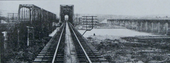
4架在1945年5月14日攻擊台灣彰化一帶的美國海軍第137巡邏轟炸中隊(VPB-137)PV-1巡邏機之中,除了兩架攻擊了烏日製糖所,另一架對大竹附近的一座工廠發射了6枚5吋火箭,但有兩枚未中。之後這架PV-1對橫跨大肚溪的鐵橋投下3枚250磅炸彈,也都沒有命中。上圖即是攻擊大肚溪鐵橋時拍下的照片,照片的前景是公路的大肚橋,後方是兩座鐵路橋,右手邊相當於南方。
Among the four PV-1 patrol planes of US Navy VPB-137 that attacked the Shoka (Changhua) area on May 14, 1945, two struck the Ujitsu Suger Refinery. Another PV-1 first fired six rockets into, and two short of, a factory near Otake (currently Dazhu). The pilot than made a bombing run against the railroad bridges across the Daitokei (Dadu River). He dropped all three bombs but all fell short. The photo on the top was taken during the bombing run. The bridge in the foreground is the highway bridge, while the twin railroad bridges are in the background. The right-hand side of the photo corresponds to the South.
下面這張1930年代由北往南面拍攝的大肚溪橋照片中,右方的公路橋並沒有最上圖看到的桁架結構。但是在「二戰時期台中鐵道大肚溪鐵橋美軍機攻擊照」這個網頁的第三張照片中,可以看到公路橋的桁架結構,所以是後來再加蓋上去的,但是其功用並不清楚。
The image below was a photo of the Daitokei bridges looking south circa 1930. Note that the highway bridge does not have the truss-like structure seen in the top photo. However, the trusses can be seen in the third photo in this blog. So the trusses must have been added between 1930 and 1945. The reason behind it is unknown to me.

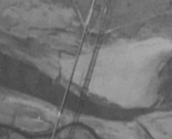
留存到現在的大肚溪鐵橋照片相當稀少,下面這張有點模糊的是美軍在1944年拍攝的偵察照片:
Photos of the Daitokei bridges are extremely rare. The next image is the aerial reconnaissance photo taken by the American military in 1944:

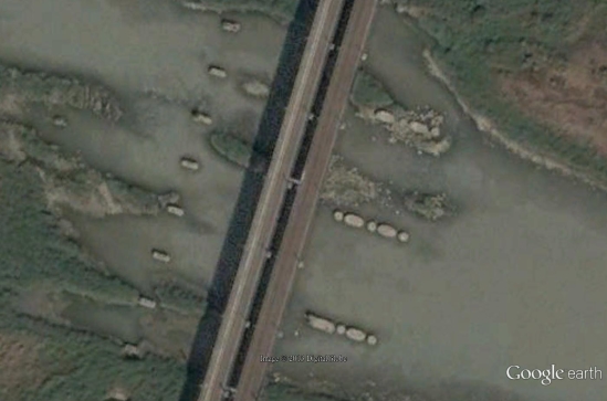
戰後,給公路走的大肚橋先被拆除,大肚溪鐵橋後來也遭遇相同命運。下面這張2003年10月25日的衛星照片尚可看見這兩座舊橋的橋墩遺跡,公路的橋墩在新鐵路橋的左側(西側),鐵路的橋墩在右側(東側):
Years after the war, the bridge for the highway was first torn down and then the twin railroad bridge met the same fate. In the satellite image below (October 25, 2003), the piers left from the old bridges can still be seen. Those for the highway are on the left-hand (West) side of the new railroad bridge, while those for the old railway are on the right-hand (East) side:

在2010年2月10日拍攝的衛星照片中,鐵路的橋墩已經被拆除:
In the February 10, 2010, satellite photo, below the old railroad bridge piers are gone:

到了2011年5月10日,衛星照片上已經看不到舊橋墩了:
By May 10, 2011, the date when the image below was taken, all old piers have gone.

以下照片(點擊可放大)也是攝於1945年5月14日的彰化地區攻擊行動,中間的空地看來像是學校(但也可能是軍營),右邊的白色樓房尤其特別。請各位網友協助「地」肉搜索這個地方,謝謝!
The following photo (click to enlarge) was also taken during the attack of the Shoka area on May 14, 1945. It appears to be a school yard (or barracks). Can anybody help identify it?
