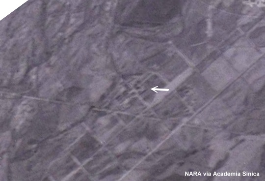
In the above photo, taken on January 31, 1945, the white arrow points to the suspected Heito (Japanese pronunciation of Pingtung) POW Camp site. The straight line, running from left to right just below the camp site, was a railway line at that time.
The next photo was taken on June 18, 1945. There seemed to be a wall surrounding the camp. According to the Never Forgotten website, American warplanes bombed the camp on February 7, 1945, killing several POWs. But it is difficult to tell the degree of damage sustained by the camp from this picture.

In the February 12, 2005, Google Earth image below, the creek by the camp site is still visible; so are some of the “grids” to the south of it. Does anyone know what the grids were for back in the 1940s?

Link to the camp site on Google Maps is here
My Father RASC Pvt Geoffrey Monument was imprisoned at Heito from Aug 29th-Nov 14th 1941.
Anyone readig this have any inormation about the camp, of know my Father?